You pull up an old deed on a rural parcel and the legal description reads something like: “Beginning at an iron pin on the north side of the county road, thence north 42 degrees east, 210 feet to a stone monument…” If that sounds confusing, you’re not alone. A metes and bounds survey is one of the oldest ways to describe property in the United States, and it still shows up on deeds across the South today. Knowing how it works can save you from a costly dispute before you ever break ground.
What “Metes and Bounds” Actually Means
The term comes from two Old English words. “Metes” refers to measured straight-line distances between points. “Bounds” refers to physical features that mark the edges of a property, like a road, a creek, a fence line, or a stone wall.
Together, a metes and bounds description traces the full perimeter of a parcel. It starts at a fixed point called the Point of Beginning (POB), moves in a specific direction for a specific distance, then turns again, and again, until it closes back at the starting point.
A basic example might read:
“Beginning at the iron pin set at the intersection of Elm Road and Oak Lane, thence N 30 degrees E, 150 feet to an iron pin; thence S 60 degrees E, 100 feet to a concrete monument…”
Each “thence” is a new leg of the boundary. When the description returns to the POB, the boundary is closed.
Where Metes and Bounds Surveys Are Still Used
The U.S. largely moved away from metes and bounds after the Land Ordinance of 1785, which introduced the Public Land Survey System (PLSS) for central and western states. But the original eastern states continued using metes and bounds for land that was already divided before the PLSS took over.
That means older rural parcels across the South, especially those that were never formally platted into a subdivision, still carry metes and bounds descriptions in their deeds. If you’re buying or developing raw acreage, there’s a real chance the deed uses this system.
Why Metes and Bounds Descriptions Cause Problems
Old descriptions were only as good as the monuments used to write them. A surveyor in 1940 might have called out “the large oak tree at the creek bend” as a boundary point. That tree could be gone now. The creek may have shifted.
This is where disputes start.
When a physical monument is missing, two adjacent property owners can end up with conflicting ideas about where the line actually falls. If the deed language is vague, or if distances in the description don’t close properly, a title company may flag the parcel. That can slow or kill a sale.
State property law in many Southern states allows adverse possession claims on boundary disputes after a set number of years of continuous use. That means a neighbor who has been maintaining land up to a disputed line long enough could have a legal claim to it, even if your deed says otherwise.
How a Metes and Bounds Survey Gets Done Today
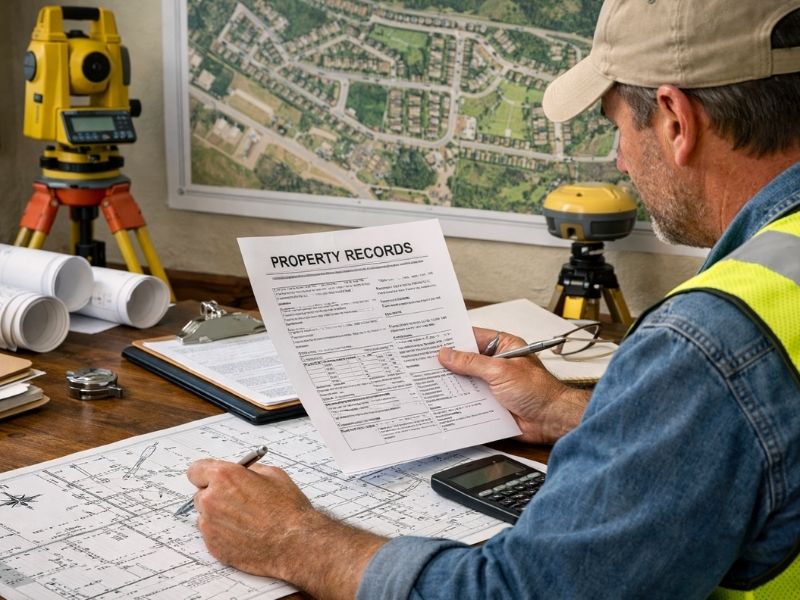
A licensed land surveyor starts by researching the deed and any recorded documents tied to the property. They look at adjoining deeds, plats, and county records to piece together the chain of title.
Then they go to the field. They look for existing monuments, iron pins, concrete markers, or any physical evidence of prior surveys. When monuments are missing, they use GPS, total stations, and other precision equipment to recalculate where the corners should be based on the written description and surrounding evidence.
Once the survey is complete, the surveyor prepares a plat showing the boundary, any discrepancies found, and the legal description that matches the actual ground conditions. That plat becomes the official record.
This process is more involved than surveying a standard subdivision lot. Rural parcels with old deed language can take more research time, which is part of why metes and bounds surveys cost more than a basic lot survey.
When You Need a Metes and Bounds Survey
You’ll likely need one in these situations:
- You’re buying rural acreage that has never been subdivided
- The deed description references old monuments that may no longer exist
- You want to build on or develop a parcel with an irregular shape
- A neighbor is disputing your boundary line
- You’re subdividing a larger tract into smaller parcels
- A title company flags the legal description during closing
Developers working on large rural tracts run into metes and bounds descriptions regularly. Getting a current survey done before closing is the only way to know if the description on paper matches what’s actually on the ground.
Metes and Bounds vs. Lot and Block: What’s the Difference?
Lot and block descriptions are used for platted subdivisions. They simply reference a lot number, block number, and the recorded subdivision plat. They’re short, clean, and easy to pull up.
Metes and bounds descriptions are used for parcels that don’t fit that system, whether because the land predates formal platting, or because the shape is too irregular for a standard grid. Rural acreage, oddly shaped commercial parcels, and older residential lots outside of recorded subdivisions often use metes and bounds.
If your deed has directions, distances, and compass bearings in it, you’re looking at a metes and bounds description.
Frequently Asked Questions
What is a metes and bounds survey?
A metes and bounds survey defines property boundaries using a series of directions and distances, starting and ending at a fixed point called the Point of Beginning. Each segment uses a compass bearing and a measured distance to trace the full perimeter of the parcel.
Are metes and bounds descriptions still common today?
Yes. Rural and older parcels across the eastern United States frequently carry metes and bounds descriptions in their deeds, especially land that was recorded before formal subdivision platting became common in the area.
What happens if a monument in a metes and bounds description no longer exists?
A licensed surveyor researches deed records and adjacent properties to reconstruct where the missing monument would have been. They use current survey equipment to re-establish the corner based on the best available evidence.
Can a bad metes and bounds description delay a closing?
Yes. If the description doesn’t close properly, references missing monuments, or conflicts with adjacent deeds, a title company may require a new survey before it will issue title insurance on the property.
How long does a metes and bounds survey take?
It depends on the size of the parcel and the condition of the existing records. Straightforward parcels with clear documentation can be completed in a few days. Older tracts with missing monuments or conflicting deeds take longer because of the additional research involved.

 Land Surveyors are professionals who make precise measurements to determine the size and boundaries of a piece of real estate. While this is a simplistic definition, boundary surveying is one of the most common types of surveying related to home and land owners. If you fall into the following categories, please click on the appropriate link for more information on that subject: