
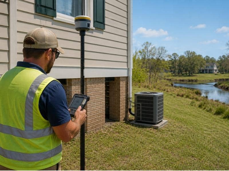
A FEMA elevation certificate is a signed document from a licensed surveyor that shows how high a building sits compared to the flood level on the official flood map. Insurers, agents, and lenders ask for it when a property sits inside or near a mapped flood zone and nobody has measured the building itself. The document supports the review. It does not decide the outcome.
Most owners meet this form for the first time when someone else demands it, usually with a deadline attached. Knowing what triggers the request makes that moment far less stressful.
When Does an Insurer Ask for a FEMA Elevation Certificate?
An insurer or lender typically asks for one when the property falls inside a Special Flood Hazard Area, when a private flood carrier writes or renews a policy, or when no elevation data exists anywhere in the file. Buildings that went up before the first flood maps existed trigger the request most often, because nobody ever recorded their height.
The flood map starts the process. Once a structure lands in a high-risk zone, the file needs a real elevation number, and a street address cannot supply one.
Lenders show up next. Federal rules require flood insurance on high-risk properties when a federally backed mortgage covers them, so the lender wants proof that the coverage matches the building on the ground.
Private flood insurers request the certificate far more often than the federal program does. FEMA introduced its Risk Rating 2.0 pricing method in October 2021, and the National Flood Insurance Program no longer needs an elevation certificate to price a policy. Private carriers still rely on it heavily. NFIP policyholders can also submit one voluntarily when the elevation works in their favor.
What Does an Elevation Certificate Actually Measure?
FEMA Form 086-0-33 records a short list of heights, and a surveyor measures every one of them in the field. The form captures:
- Lowest floor elevation, meaning the height of the lowest usable floor, including any basement
- Lowest adjacent grade, meaning the lowest ground that touches the outside of the building
- Machinery and equipment elevation, covering the HVAC unit, water heater, and similar gear
- Base flood elevation, the height floodwater would likely reach in a flood with a 1% chance of occurring in any given year
- Flood zone and map panel, the official designation the insurer starts from
The gap between the lowest floor and the base flood elevation carries the most weight. A floor above that line faces less exposure. A floor below it faces more. Surveyors tie these readings to a published vertical benchmark, usually NAVD 88, so the numbers hold up under review rather than floating on a rough estimate.
Why Do Homes Near a Flood Zone Edge Need One?
Flood maps get drawn at a regional scale, so a boundary line can slice straight through a single lot. Half a parcel reads high risk. The other half reads moderate. The building in the middle sits in limbo, and the map alone never resolves it.
Two houses can share a block, share a zone, and still sit four feet apart in height. One takes on water during a bad storm. The other stays completely dry. That difference shows up nowhere on the map.
A survey closes the gap with measured data. The surveyor shoots the actual elevations, ties them to a known benchmark, and puts the building’s true position on paper. The insurer then weighs those numbers against its own underwriting rules and reaches a decision.
Do You Need a New Certificate at Renewal or Refinance?
Elevation certificates carry no expiration date, so an older document often works fine. Several situations still prompt a fresh request.
Switching carriers restarts the review from scratch. The new insurer runs its own process and may want elevation data that the previous policy never asked for. Refinancing works much the same way, because the new lender orders a fresh flood determination on the property.
Map revisions cause the biggest surprises. Communities update their flood maps every few years, and one revision can pull a property into a zone that never applied before. Owners who never thought about flood risk suddenly find a documentation request in their inbox.
Physical changes to the structure matter too. Additions, raised foundations, and relocated mechanical equipment all shift the numbers on the form. Once the building changes, the old certificate describes a building that no longer exists.
What Should You Prepare Before Ordering One?
A short prep list keeps the survey efficient and the results usable on the first pass. Gather these items before you call:
- Property address and parcel number
- Flood map panel number and the current flood zone
- Any prior elevation certificate, even an outdated one
- Access to the crawl space, basement, garage, and mechanical areas
- The written reason for the request from your insurer, agent, or lender
That last item saves the most time. Different requests call for different sections of the form, and a surveyor who understands the purpose upfront collects the right data during a single visit. Confirm the exact requirement with your insurer first, and a second trip to the property becomes far less likely.
Frequently Asked Questions
Does every property in a mapped flood zone need a FEMA elevation certificate?
No. The requirement depends on the flood designation, the lender, the insurance provider, and whatever records already exist for the building. NFIP policies no longer need one for pricing, though private carriers and local floodplain permit offices frequently do. Confirm with your insurer and lender what your specific file requires.
Can a FEMA elevation certificate guarantee a lower insurance premium?
It cannot. The certificate supplies verified elevation numbers, and the insurer feeds those numbers into its own rating and underwriting process alongside other factors. Favorable elevation data may work in your favor, though the pricing decision belongs entirely to the insurer.
Who is allowed to complete a FEMA elevation certificate?
A licensed land surveyor, a registered professional engineer, or a licensed architect can certify the form, provided state law authorizes that professional to determine elevations. Homeowners cannot fill it out themselves, because the value of the document rests on the certifying professional’s field measurements and signature.