Metes and Bounds Survey Before Correcting Historic Parcels
Posted on September 17,2026 by Madison Surveyor
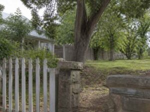
Old land descriptions carry old problems. A deed written a century ago may point to a tree that fell long ago or a fence that rotted away. The words on paper may not match the ground you can walk today. That gap can stall a sale, block a permit, or spark a fight with a neighbor.
A metes and bounds survey is how you fix that gap. It uses careful research and field work to figure out where a historic parcel really sits. For owners of older land, this survey turns a confusing deed into a clear, current boundary. This guide walks through how the process works and what to expect.
The stakes are real. In fast-growing areas like Madison, older parcels often sit next to new development. When someone builds, subdivides, or sells, those old descriptions get tested. A correction done right protects your rights and keeps your project moving.
Understanding the Existing Metes and Bounds Description
A metes and bounds description defines land by direction and distance. It reads like a set of walking directions around the edge of a parcel. Each line has a bearing, which is the direction, and a distance, which is the length. The description also names monuments and reference points along the way.
The surveyor starts by reading this description closely. They study the bearings and distances that trace the parcel’s shape. They note the monuments called out in the deed, such as iron pins, stones, or old trees. They also look at how the parcel connects to the land around it.
This first read reveals a lot. It shows whether the description closes, meaning the lines return to the start. It flags calls that seem off or vague. Older deeds often use landmarks that no longer exist. That is a clue that field work will be needed to sort things out.
Adjoining parcels matter here too. Your boundary is shared with your neighbors. The surveyor checks how your description lines up with theirs. Gaps or overlaps between deeds are common in historic land. Spotting them early sets the stage for the rest of the survey.
Researching Deeds, Plats, and Earlier Survey Records
Field work alone cannot fix an old boundary. The surveyor also digs through records. This research builds the history of how the parcel was created and changed over time. It often uncovers the source of the problem.
The surveyor pulls and compares several kinds of records:
- The current deed and earlier deeds in the chain of title
- Recorded plats that show the parcel and its neighbors
- Earlier survey records and field notes
- Records for adjoining properties
Comparing these documents reveals patterns and problems. A surveyor looks for gaps where land seems to belong to no one. They look for overlaps where two deeds claim the same strip. They watch for conflicting calls, where one document says one thing and another says something else.
Transcription errors are a frequent culprit. Deeds were copied by hand for generations. A wrong number or a flipped direction can throw a whole description off. The surveyor also tracks changes over time, such as a parcel that was split or partly sold. Each change can leave a mark on the description that needs to be understood.
Recovering Monumentation and Boundary Evidence in the Field
With the research done, the surveyor heads to the property. The goal is to find physical evidence of the boundary. This step ties the words in the deed to real points on the ground. It is often the most telling part of the whole survey.
Monuments are the prize here. These are the physical markers that define corners. The surveyor searches for original monuments named in old deeds, like an iron pin or a buried stone. When those are gone, they look for replacement monuments set by later surveys. Finding an old corner can anchor the entire parcel.
Other evidence helps fill the picture. The surveyor records occupation lines, which show how the land has actually been used. These include:
- Fences and hedgerows that mark long-held lines
- Old roads and driveways that follow a boundary
- Walls, tree lines, and other lasting features
This evidence carries weight because it shows how people treated the boundary for decades. A fence standing for fifty years tells a story. The surveyor measures and documents each piece. Later, they weigh it against the written record to reach a sound conclusion.
Resolving Conflicts Between Records and Field Conditions
Records and reality often disagree. The deed may call for 200 feet, but the fence sits at 195. A monument may turn up in a spot the description did not predict. Resolving these conflicts is the heart of a metes and bounds survey.
The surveyor does not just pick the easy answer. They apply professional standards and long-settled boundary principles. These principles guide which evidence carries the most weight. As a general rule, original monuments often outrank recorded distances, and long-standing occupation can matter too. The exact outcome depends on the facts of each parcel.
This is skilled judgment, not guesswork. The surveyor weighs the deed, the plats, the monuments, and the occupation lines together. They consider how neighboring descriptions fit. The result is a reasoned opinion of where the true boundary lies.
Boundary law and standards can vary by state, county, and situation. A surveyor works within the rules that apply to your property. When a conflict touches legal rights, they may advise you to consult an attorney. The survey gives you the facts you need to make that call with confidence.
Preparing Information for a Parcel Description Correction
Once the boundary is resolved, the survey supports the fix. The findings become the basis for corrected documents. This is where months of research and field work turn into something you can record and rely on.
The surveyor can prepare a revised legal description. This new description uses current bearings, distances, and monuments that match the ground. It replaces the vague or broken language of the old deed. A clean description makes future sales and permits far smoother.
A survey plat often comes with it. This is a drawing that shows the corrected parcel, its dimensions, and the evidence found. It gives a clear visual record of the boundary. Recording authorities and title companies both value this kind of documentation.
Requirements for recording a correction vary by county and recording authority. Some corrections are simple. Others may need extra steps or legal review. Your surveyor can tell you what your local office expects. Confirm these needs early, especially if a sale, permit, or construction schedule depends on the corrected description.
Fixing a historic parcel takes patience and skill, but the payoff is a boundary you can trust. A licensed land surveyor can research the records, recover the evidence, and prepare the documents needed to set your parcel right. If an old description is holding up your plans, reach out early and give the process room to be done correctly.
For a free land surveying quote, call us at (256) 585-6346 or send us a message by going here.
Posted in land surveying, land surveyor | Tagged boundary surveying