As Built Surveys After Completing Water Treatment Expansions
Posted on by Madison Surveyor
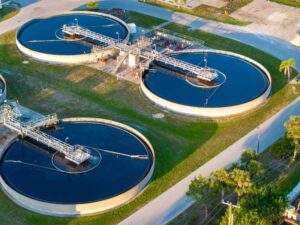
A finished water treatment expansion looks done once the concrete cures and the equipment starts running. But plans on paper rarely match exactly what got built in the field. Small shifts happen during construction. Those shifts matter a lot for a facility that has to run safely for decades.
As built surveys close that gap. They record what was actually built, not just what the design plans intended. Growth has pushed steady investment into water infrastructure. For municipalities and utility providers here, this kind of documentation becomes part of the facility’s permanent record.
This article covers what an as built survey should capture after a water treatment expansion. It also explains why each piece matters for operations down the road.
Verify Final Locations of New Treatment Infrastructure
The first step in an as built survey is confirming where new infrastructure actually ended up. Tanks, filtration units, pump stations, and other components can shift slightly during construction, even when the design called for something different.
A surveyor locates each major structure and checks it against the approved plans. Small differences are common and usually fine. But undocumented differences can cause real problems later, especially if a future project assumes the plans match reality.
This verification typically covers:
- Coordinates and elevations for new tanks, basins, and treatment structures
- Locations of pump stations and mechanical buildings
- Positions of access points, gates, and site boundaries tied to the expansion
- Any structure that shifted from its original design location during construction
Getting this right protects the facility’s long-term records. Operators, engineers, and future contractors all depend on this data being accurate, not just close.
Document Finished Elevations Across Expanded Facility Areas
Water treatment facilities depend heavily on gravity flow. So elevation accuracy matters more here than on many other types of construction. An as built survey documents finished elevations across the whole expanded area, not just a few key points.
This step confirms that grading, structure elevations, and flow paths were built the way the design intended. A treatment process relies on water moving correctly from one stage to the next. Even small elevation errors can affect how well that process works.
Elevation documentation usually includes:
- Finished floor elevations for new buildings and structures
- Top of wall and invert elevations for tanks and basins
- Site grading elevations across the expanded footprint
- Elevation data at key flow transition points in the treatment process
This record becomes especially useful if operational issues come up later. Accurate elevation data helps engineers troubleshoot problems using real numbers, not design assumptions that may not match what got built.
Map Completed Piping, Utilities, and Access Improvements
Treatment plant expansions involve a lot of infrastructure that gets hard to see once construction wraps up. Piping gets buried. Utilities get connected. Access roads get paved over what used to be open ground. An as built survey maps all of it before it disappears from view.
This mapping matters for daily operations and for any future work on the water treatment site. Nobody wants to guess where a buried pipe sits when a repair crew shows up years later.
Key features to map include:
- Piping routes, sizes, and depths across the expanded area
- Utility connections, including power, water, and communication lines
- New access roads, gates, and paved areas added during the expansion
- Valve locations, manholes, and other access points needed for maintenance
This record becomes part of the facility’s operational documentation. It often gets used more often than people expect once the project wraps up.
Compare Constructed Features With Approved Design Plans
Once the field data is collected, the survey compares what got built against the approved design plans. This comparison is where an as built survey earns its value. It shows exactly where construction matched the plans, and where it did not.
Differences between design and construction happen for many reasons. Field conditions, unexpected utility conflicts, or small design changes approved mid-construction can all lead to a finished facility that differs slightly from the original drawings.
This comparison should identify:
- Structures or utilities that moved from their original design position
- Elevation differences between the design plans and what was actually built
- Design elements that were changed or left out during construction
- Any changes that may need updated permits or regulatory paperwork
Municipalities and engineers use this comparison to confirm the finished facility meets its design intent and any regulatory requirements tied to water treatment operations.
Create Reliable Records for Operations and Future Expansion
The final purpose of an as built survey is building a record that lasts well beyond the current project. Water treatment facilities get expanded, upgraded, and repaired many times over their operational life. Accurate as built data supports every one of those future projects.
Facilities without reliable as built records often face slower, more expensive planning for future work. Engineers end up spending extra time verifying existing conditions instead of relying on accurate historical data.
A reliable as built record supports:
- Future expansion planning based on accurate existing conditions
- Maintenance and repair work that requires knowing exact infrastructure locations
- Regulatory reporting that may require documentation of constructed facilities
- Asset management systems that track infrastructure location and condition over time
These requirements can vary by municipality, utility provider, and project scope. It is worth confirming specific documentation standards with local regulatory agencies early. If your facility’s operations or future planning depend on accurate records, schedule your as built survey as soon as construction wraps up. Do not wait until the information becomes harder to verify.
For a free land surveying quote, call us at (256) 585-6346 or send us a message by going here.
Posted in land surveying, land surveyor | Tagged cost of land surveying, estimating the cost of land surveying, land surveying cost, land surveying cost Madison